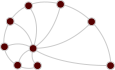
new_spain_roads — Travel routes in 18th century New Spain
- Description
The network of travel routes among the parishes, temples and towns of the archbishopric of Mexico in 18th century New Spain, transcribed from the anonymous painted map "Plano del arzobispado de México", held by the Instituto Nacional de Antropología e Historia (INAH) in Mexico. The map shows the places connected by paths annotated with the travel distances between them. The map was brought to attention by S. B. Weingart, and the network was transcribed by C. Uhl in June 2018, and distributed by A. Clauset. According to the transcriber, some of the distances were difficult to decipher, so some values may be inaccurate. The place names are not included.
An undirected edge connects two places joined by a path on the map.
The network has the following properties:
- Edges:
weight, the travel distance between the two places, as written on the map (the unit is not given in the data).
- Edges:
- Tags
- Transportation Roads Weighted Spatial
- Citation
-
- Anonymous, "Plano del arzobispado de México" (18th century), Instituto Nacional de Antropología e Historia, Mexico lugares.inah.gob.mx
- Upstream URL OK
- https://aaronclauset.github.io/datacode.htm
- Networks
-
Tip: hover over a column header for a description.
Column legend
- $\left<k\right>$
- Mean degree
- $\sigma_k$
- Standard deviation of the degrees
- $\lambda_h$
- Largest eigenvalue of the Hashimoto (non-backtracking) matrix
- $\tau$
- Random walk mixing time
- $r$
- Degree assortativity
- $c$
- Global clustering coefficient
- $\oslash$
- (Pseudo-) diameter
- $S$
- Relative size of the largest component
- NPs
- Node properties
- EPs
- Edge properties
- Ridiculograms*
-