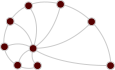
russian_trade — Medieval Russian river trade network (1978)
- Description
The network of river trade routes among 39 towns of medieval Russia (12th-13th centuries), as reconstructed by the geographer F. R. Pitts to study the growth of Moscow. Towns are connected if they were adjacent along the network of navigable rivers (and portages), which were travelled by boat in summer and by sled over the ice in winter, and which supported trade (e.g. of slaves, amber, honey and furs) and other social exchanges. The data were distributed by A. Clauset, together with the article by Pitts (1978).
The network has the following properties:
- Nodes:
name, the name of the town. The data file only gives node numbers; the names were assigned from Table 1 of Pitts (1978), assuming the nodes are numbered in the order of that table (the shortest-path distances computed from the network agree closely with the ones listed there). Three unnamed places are labeled "A", "B" and "C" as in the original table.
- Nodes:
- Tags
- Economic Trade Unweighted Spatial
- Citation
-
- F. R. Pitts, "The medieval river trade network of Russia revisited." Social Networks 1(3), 285-292 (1978) 10.1016/0378-8733(78)90025-4 Sci-Hub
- Upstream URL OK
- https://aaronclauset.github.io/data/russiantrade.zip
- Networks
-
Tip: hover over a column header for a description.
Column legend
- $\left<k\right>$
- Mean degree
- $\sigma_k$
- Standard deviation of the degrees
- $\lambda_h$
- Largest eigenvalue of the Hashimoto (non-backtracking) matrix
- $\tau$
- Random walk mixing time
- $r$
- Degree assortativity
- $c$
- Global clustering coefficient
- $\oslash$
- (Pseudo-) diameter
- $S$
- Relative size of the largest component
- NPs
- Node properties
- EPs
- Edge properties